


20220322-La Bouille

doudet
User
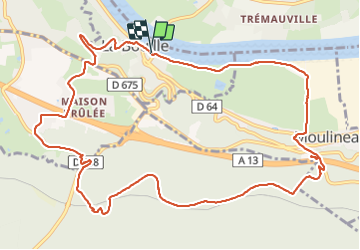

Length
12.8 km

Max alt
135 m

Uphill gradient
228 m
Km-Effort
15.8 km

Min alt
0 m

Downhill gradient
227 m
Boucle
Yes
Creation date :
2022-03-22 12:54:20.519
Updated on :
2022-03-23 07:24:57.833
3h36
Difficulty : Medium

FREE GPS app for hiking
 SityTrail
IGN / Geographical institutes
SityTrail Plus
The world is yours!
About
Trail Walking of 12.8 km to be discovered at Normandy, Seine-Maritime, La Bouille. This trail is proposed by doudet.
Description
Boucle A-R au départ du Parking du Bac de La Bouille
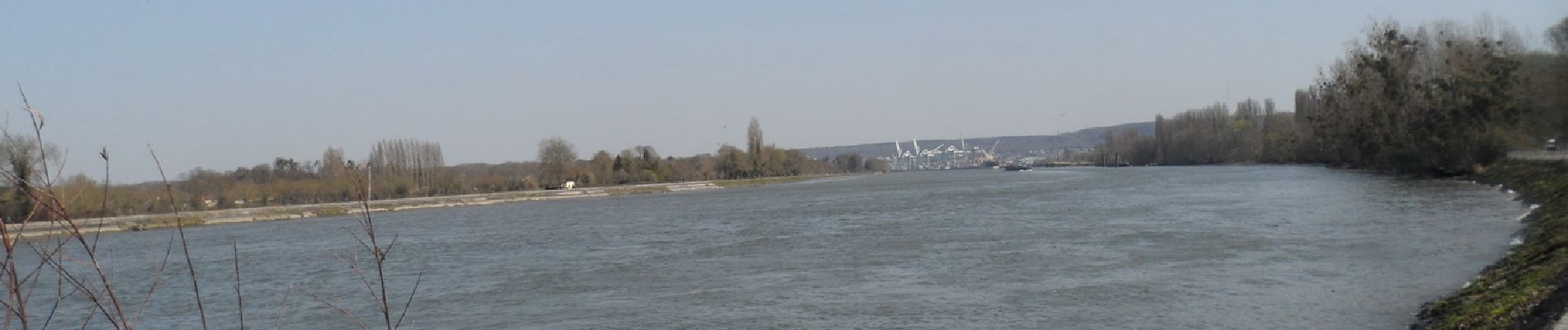
Photos


38 photos in total. Please click on a photo to see them all in the gallery.
Positioning
Country:
France
Region :
Normandy
Department/Province :
Seine-Maritime
Municipality :
La Bouille
Location:
Unknown
Start:(Dec)
Start:(UTM)
349889 ; 5468558 (31U) N.
Comments